
Surrey landmark guide
Explore Surrey's Landmarks and Historic Places
Independent guide prepared by WaterLine Plumbing
Hero photo: Arnold C. Attribution required
Use this guide to Find out more about surrey through places that reveal its history, geography, civic growth, and relationship with the international border.
Surrey's landmarks are not all monuments in the traditional sense. Some are historic buildings, some are public institutions with distinctive architecture, and others are landscapes that residents immediately associate with the city. Together, Historic Stewart Farm, the Museum of Surrey, Peace Arch, City Hall, City Centre Library, and Crescent Beach show how Surrey developed from agricultural and river communities into a large urban municipality.
Every featured landmark below has an official source, a photograph of the actual place, an exact address, a map, and driving directions from WaterLine Plumbing of Surrey. The guide uses original prose and primary visitor information rather than reproducing another article. Opening hours, ceremonies, construction, border conditions, and park access can change. Confirm current details with the responsible organization and remember that a landmark can remain culturally important even when a building is closed to visitors.
Historic Stewart Farm
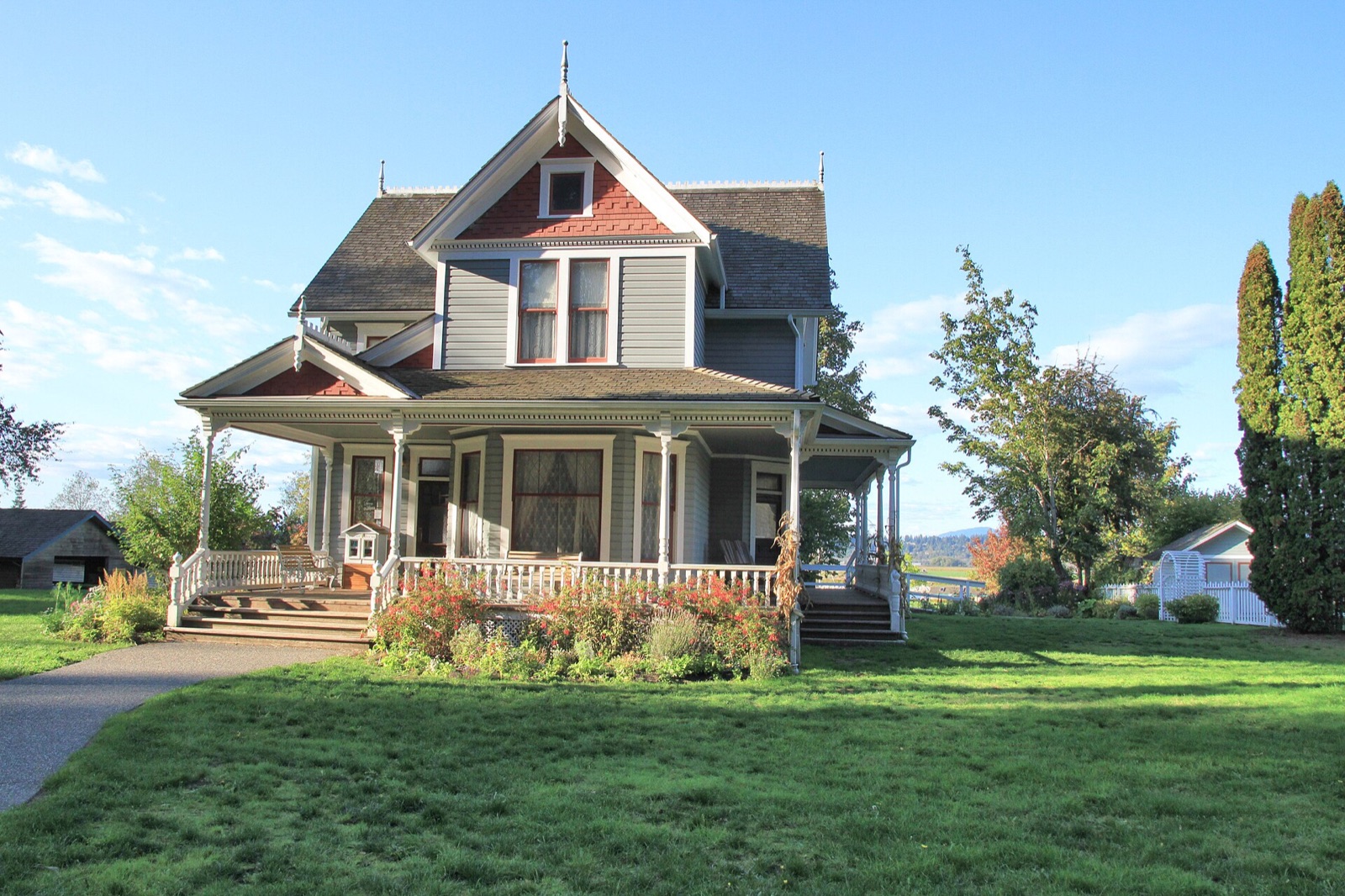
Historic Stewart Farm preserves a tangible connection to settlement, agriculture, domestic life, and the Nicomekl River landscape.
The farmhouse and surrounding grounds help visitors read history through place. Building materials, room arrangements, tools, gardens, and the river setting reveal more than a date on a plaque can convey. Interpretive programs may explore household work, food, crafts, or seasonal traditions. Because program and interior access hours vary, check the official page before making the house the centre of a trip.
Walk the wider Elgin Heritage Park landscape to understand why the site matters. The Nicomekl River once shaped movement and work in ways that are easy to overlook from a modern road. Take photographs without crossing barriers or handling protected objects. Families can ask children to compare historical routines with their own home life. Suitable footwear is helpful because outdoor conditions change with the weather.
- Confirm farmhouse hours separately from general park access.
- Leave time for the river setting and outdoor heritage landscape.
- Follow staff guidance around original and restored features.
Two maps for this place
Historic Stewart Farm
13723 Crescent Rd, Surrey, BC V4P 1J4
Map of Historic Stewart Farm
Open place mapDirections from WaterLine to Historic Stewart Farm
Open directionsMuseum of Surrey
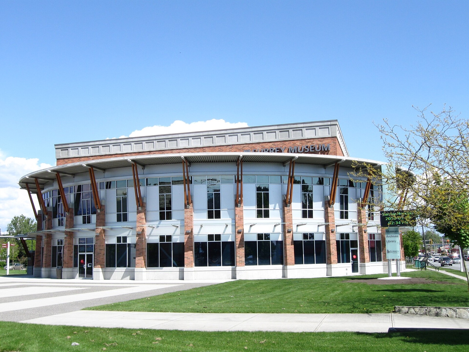
Museum of Surrey collects and interprets stories connected to Surrey's communities and provides a modern cultural landmark in Cloverdale.
The museum complements historic sites by bringing many periods, communities, and themes into one institution. Changing exhibitions mean repeat visits can offer different perspectives. Start with the current exhibition listing and event calendar, then decide how long to allow. A special program may require registration even when regular gallery access does not.
Use the museum as a bridge between Surrey's past and present. Exhibits can prompt questions about immigration, industry, communication, daily life, and the evolution of neighbourhoods. Read labels carefully and notice whose voices are represented. Visitors researching family or community history can ask staff what resources are available, while understanding that archival access may follow a separate process.
Two maps for this place
Museum of Surrey
17710 56A Ave, Surrey, BC V3S 5H8
Map of Museum of Surrey
Open place mapDirections from WaterLine to Museum of Surrey
Open directionsPeace Arch Provincial Park
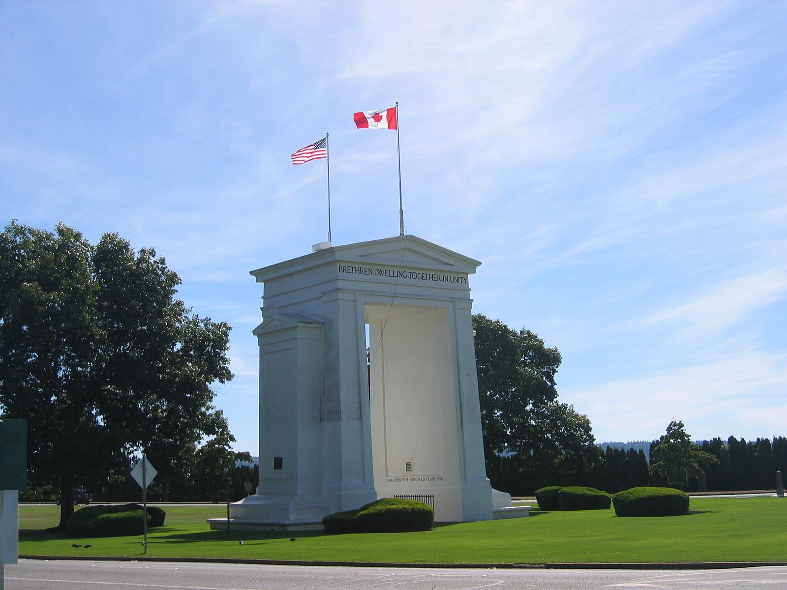
Peace Arch Provincial Park contains the internationally recognized Peace Arch monument at the Canada and United States boundary.
The monument is both a familiar regional symbol and a place with unusual operational considerations. The park's relationship to an international boundary means visitors should review current BC Parks information and comply with all border and law-enforcement instructions. Do not assume that an informal description of the park explains current access, parking, identification, or movement between areas.
Visit with respect for the site's commemorative purpose and the people using the nearby border crossing. Traffic can be heavy, and border wait times can affect surrounding roads even when you are not crossing. Check weather and park notices, supervise children closely, and keep documents secure. The formal lawns and monument provide a clear visual contrast with Surrey's forest, farm, and waterfront landmarks.
Two maps for this place
Peace Arch Provincial Park
138 Peace Park Dr, Surrey, BC V3S 9N8
Map of Peace Arch Provincial Park
Open place mapDirections from WaterLine to Peace Arch Provincial Park
Open directionsSurrey City Hall
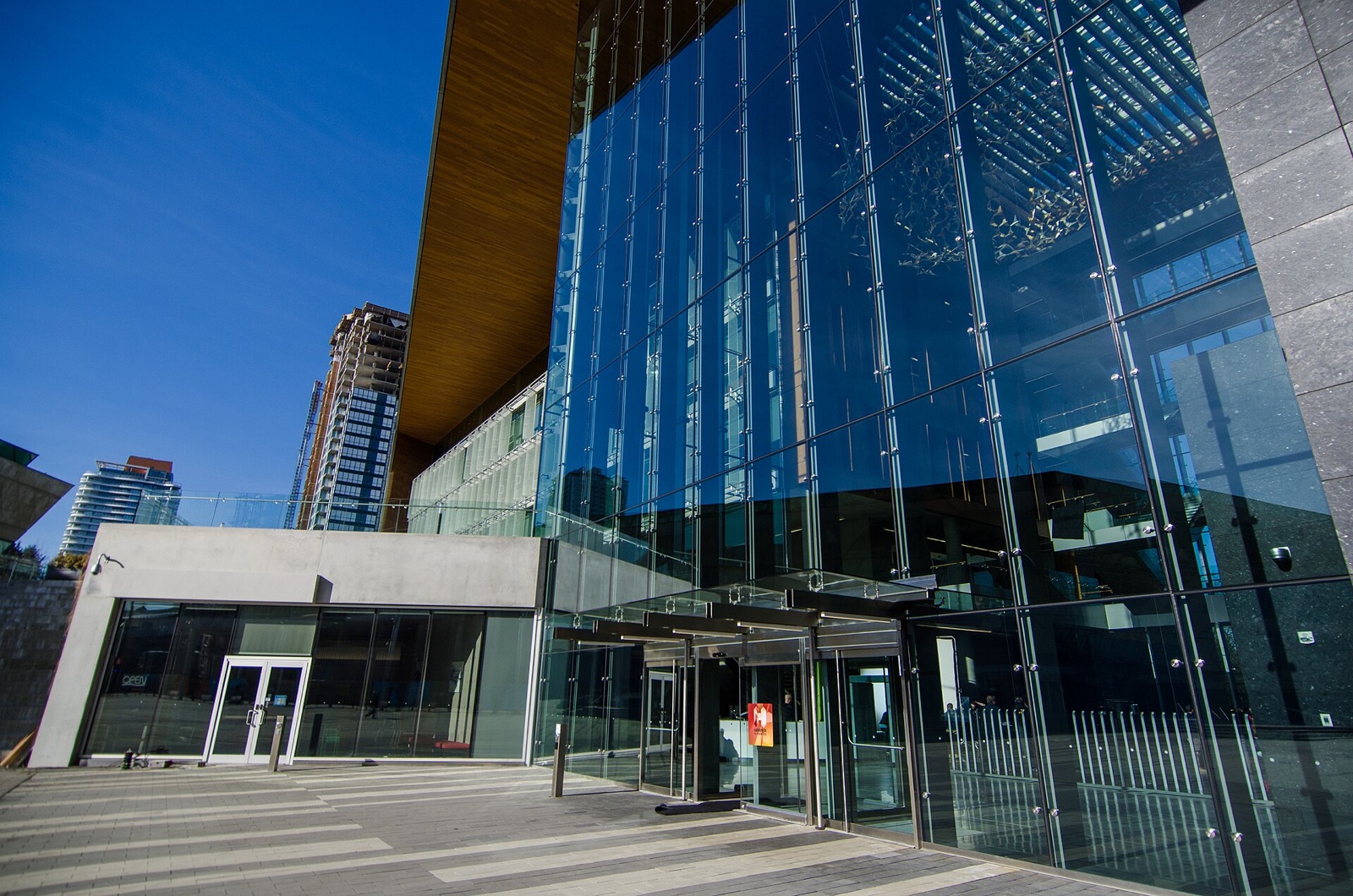
Surrey City Hall represents Surrey's contemporary civic identity and the continuing development of City Centre.
City Hall is a working government building rather than a conventional tourist attraction, but its architecture and position beside Civic Plaza make it a recognizable modern landmark. Public access depends on building operations, meetings, security, and scheduled events. Review the official page before visiting for a specific service or council proceeding.
The surrounding civic district demonstrates Surrey's urban growth. Standing in the plaza places City Hall, City Centre Library, transit, education, residential towers, and commercial spaces within a short walk. That concentration makes the area useful for an architecture-focused visit. Respect working spaces and event boundaries, and do not enter restricted areas for a photograph.
Two maps for this place
Surrey City Hall
13450 104 Ave, Surrey, BC V3T 1V8
Map of Surrey City Hall
Open place mapDirections from WaterLine to Surrey City Hall
Open directionsSurrey City Centre Library
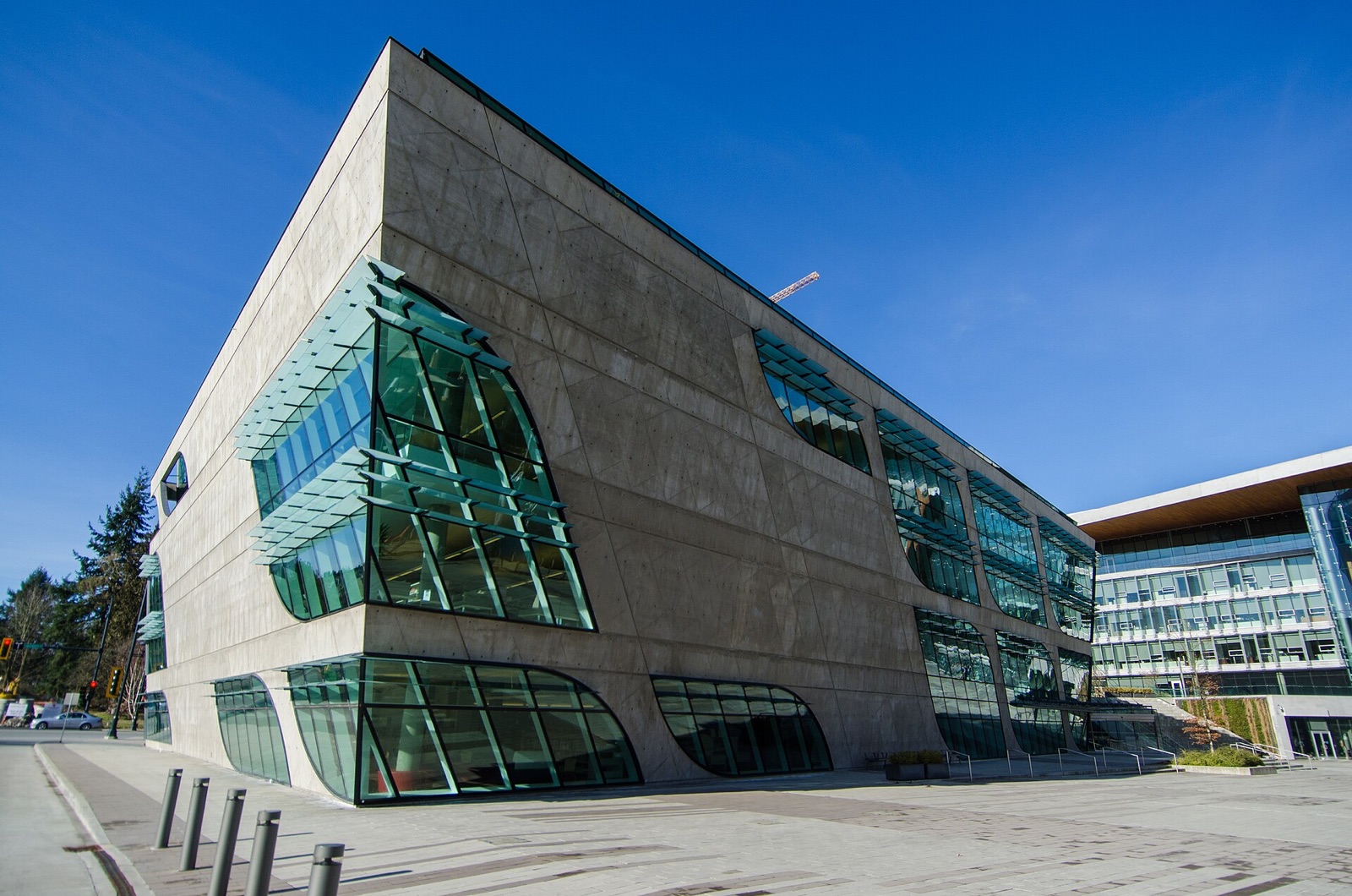
Surrey Libraries City Centre Branch is known both as an active public library and as a distinctive piece of contemporary civic architecture.
The library's curved exterior and multi-level interior make it one of City Centre's most recognizable public buildings. It should still be experienced as a library first. Programs, study spaces, collections, newcomer services, and technology access matter as much as the facade. Check branch hours and program registration on the official site.
Photographers should avoid disrupting patrons and should follow library rules about photography inside. Visitors can combine the branch with Civic Plaza and City Hall for a compact walking route. If you are new to Surrey, ask about library membership and digital resources. The building illustrates how a civic landmark can be visually memorable while serving practical daily needs.
Two maps for this place
Surrey Libraries City Centre Branch
10350 University Dr, Surrey, BC V3T 4B8
Map of Surrey Libraries City Centre Branch
Open place mapDirections from WaterLine to Surrey Libraries City Centre Branch
Open directionsCrescent Beach and Blackie Spit
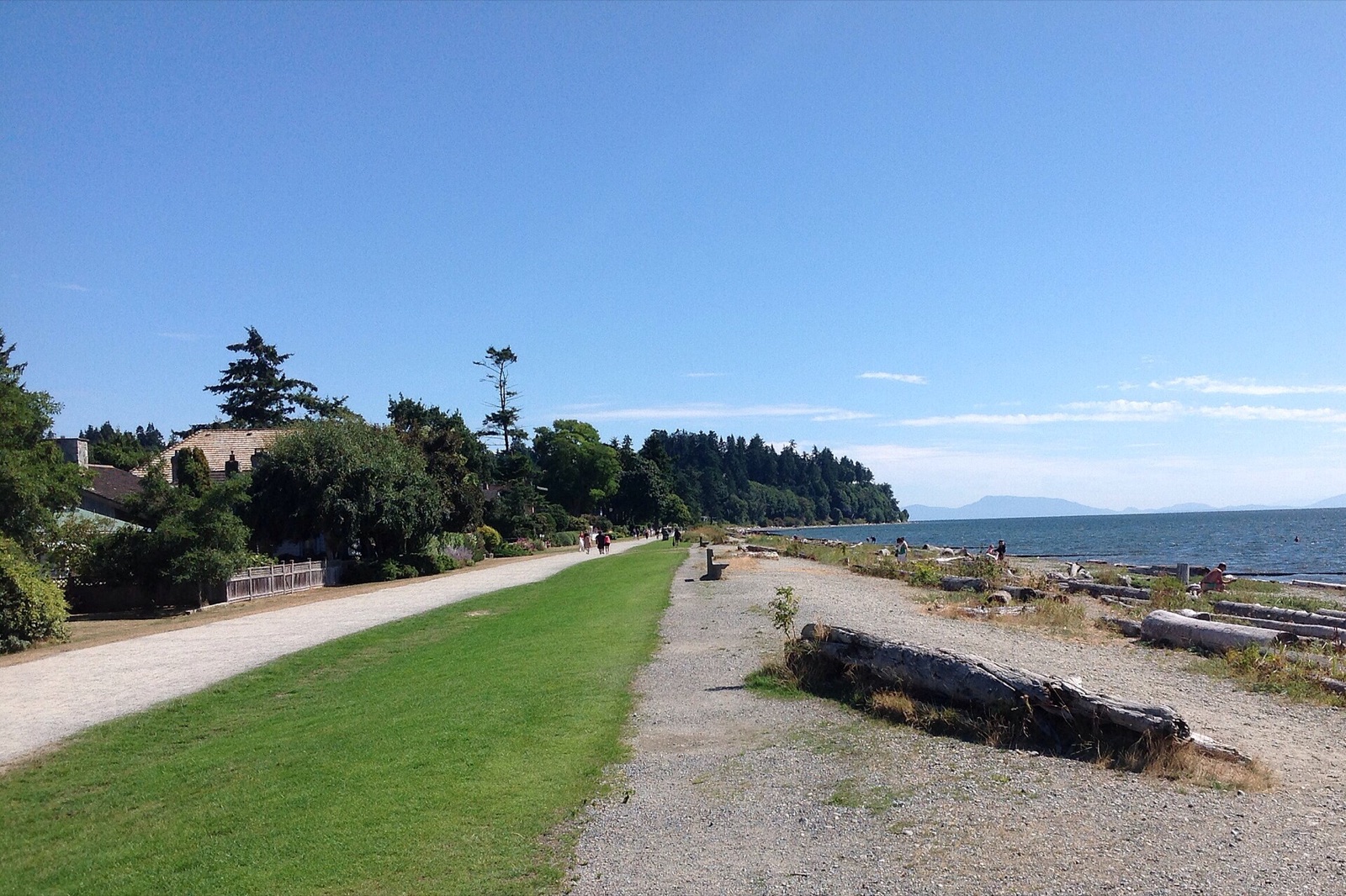
Blackie Spit Park protects a coastal landscape closely associated with Crescent Beach, Boundary Bay, and Surrey's natural identity.
A landmark does not need walls. The shoreline, views, bird habitat, and low coastal profile make Crescent Beach immediately different from Surrey's central urban districts. Tides and weather constantly change the experience. Follow posted habitat protections, stay on designated routes, and keep a respectful distance from birds and other wildlife.
Warm weekends can create parking pressure, so arrive early or choose a quieter time. Bring a layer, check conditions, and supervise children near the water. Residents may think of the beach as familiar, but its environmental value is one reason it remains significant. Pair it with Historic Stewart Farm to compare two South Surrey landscapes shaped by water.
Two maps for this place
Blackie Spit Park
3136 McBride Ave, Surrey, BC V4A 3G9
Map of Blackie Spit Park
Open place mapDirections from WaterLine to Blackie Spit Park
Open directionsRead Surrey's history through buildings and landscapes
These landmarks make the most sense together. Stewart Farm and the museum interpret earlier communities, Peace Arch reflects Surrey's border location, City Hall and the library express modern civic growth, and Crescent Beach preserves a defining coastal landscape. Group nearby stops and leave enough time to observe how each place relates to its surroundings.
WaterLine Plumbing serves the communities around every landmark in this guide. The linked public organizations control access, programs, and visitor rules. If a plumbing issue requires help at a Surrey home or business, call WaterLine 24 hours a day at 778-562-5628.
Sources and research notes
Organic-result research checked October 25, 2026 for the query “Surrey BC landmarks historic places.” The first conventional web result observed was Surrey attractions and landmarks search result. Directory-style search results were used only to understand intent. Primary government and institutional pages support the venue details. This article is original editorial work informed by the cited sources and does not reproduce their protected prose.
- City of Surrey: Historic Stewart Farm
- City of Surrey: Museum of Surrey
- BC Parks: Peace Arch Park
- City of Surrey: City Hall
- Surrey Libraries: City Centre Branch
- City of Surrey: Blackie Spit Park
Venue details, schedules, menus, prices, regulations, products, and availability can change. Confirm current information with the linked official source before making plans or purchasing equipment.